Provincial agrologists are currently touring Electoral Area F (Errington, Coombs and Hilliers) to collect information on crops, irrigation, livestock, and land-use for farming areas.
The crew, which will also tour Nanaimo, will navigate public roads and observe land from within the vehicle, often with binoculars.
Residents are advised to watch for a pickup truck with B.C. Ministry of Agriculture magnetic signs on both doors in farming areas through Aug. 23.
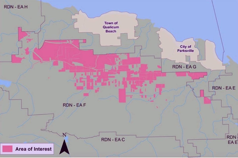
Agriculture is an important sector in the area, and to help ensure its viability the Ministry of Agriculture, Regional District of Nanaimo, and the Partnership for Water Sustainability in BC have partnered to update the Agricultural Land Use Inventory (ALUI) & Water Demand Model (WDM) from 2012.
The Agricultural Land Use Inventory will define the amount of actively farmed land as of 2019; provide a measure of change since the last inventory in 2012; and inform a review of the Official Community Plan.
The Agricultural Water Demand Model will enable examination of water management alternatives that consider future land use changes; Define potential impacts of climate change and identify appropriate adaptation strategies and inform future water storage modeling projects.
— NEWS Staff, submitted