The Electoral Area E Parks and Open Spaces Advisory Committee has identified beach accesses to include in a five-year work plan in Nanoose Bay.
An inventory of beach accesses was completed in the summer of 2017 by a subcommittee of the POSAC and determined sites that are feasible for signage and other improvements such as trails.
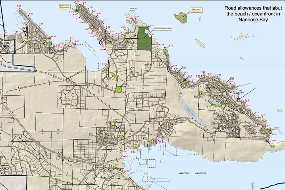
There are more than 60 oceanfront provincial road allowances identified that are under the jurisdiction of the Ministry of Transportation and Infrastructure.
The Regional District of Nanaimo does not own or manage roads or beach accesses but can install and maintain signs, trails, benches, stairs and parking with consent from the ministry. Currently, none of the public beach accesses locations in Nanoose Bay are currently signed, developed or maintained by the RDN but there are some areas that already have footpaths or other features to allow access to the beach.
The plan is to gain a permit for development from the ministry. Once that is achieved, the RDN becomes responsible for improving the sites for park and trail purposes.
The RDN already holds permits for Electoral Areas A, B, G and H.
The inventory of beach accesses in Nanoose Bay has been ranked from one to five with one being very suitable for simple development like signs and trails; two is suitable with constraints (e.g. stairs required); three requires significant modifications; four is not suitable; and five is already developed or partially development.
A dozen sites were identified for development and signage considerations but four areas were noted as possible beach access development projects.
They include E-29: undeveloped road allowance that runs east-west at the end of Stewart Road east of Moorecroft Regional Park; E-53: undeveloped road allowance that runs east-west between 1675 and 1661 Claudet Road; and E-04: undeveloped road allowance at the end of Rowland Road adjacent to Rowland Road Community Park. Other sites visited, as well as some sites ranked 5 could be considered for signage if they already have a footpath in place.
For 2019, the goal is to develop a signage plan with some of the beach access sites with existing footpaths. The Snaw-Naw-As First Nation will be consulted regarding this plan as well input from the community will be sought.
A summary of candidate sites for signage and priorities will be created that include assessment of site opportunities and recommendations on the best signage for each possible location.
A budget of $1,000 has been earmarked in the 2019 Area E Community Parks Budget to cover the costs of installing the signs.