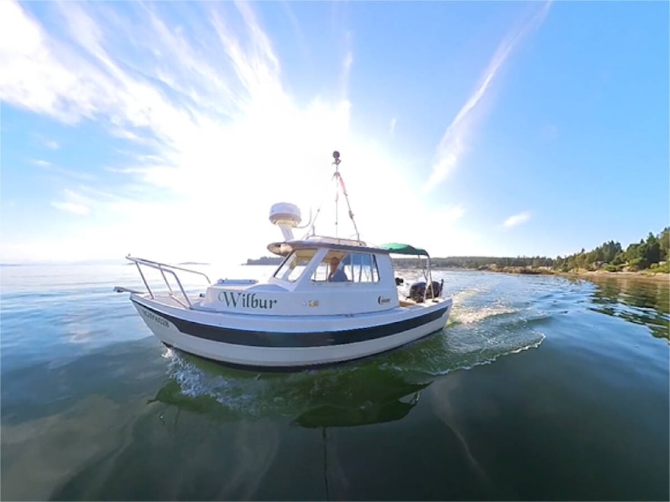
A tiny boat named Wilbur is heading down the east coast of Vancouver Island this week with the goal of mapping the shoreline from Parksville to Campbell River.
The Pacific Salmon Foundation’s 16-ft research boat Wilbur is mapping the shoreline along the east coast of Vancouver Island by recording 360-degree video footage and high-resolution photos of the shoreline of the East Coast of Vancouver Island from Victoria to Port McNeill over the next few years to identify the extent of shoreline modifications.
Wilbur and her crew will be in the area between Parksville and Campbell River until Tuesday, July 18. Starting Friday it will be between French Creek and Deep Bay. Saturday the vessel will travel to Comox, and Sunday it will make the trip to north of Campbell River.
Healthy shorelines are essential for the survival of many plant and animal species, including forage fish such as surf smelt and Pacific sand lance, which are critical food for Pacific salmon. However, many shorelines have been modified with structures like seawalls, rip rap, piers, and docks, which can impede natural coastal processes and disrupt habitat.
With Wilbur’s help, PSF’s Resilient Coasts for Salmon team will be able to see how much of the shorelines have been modified and identify areas where there may be challenges for the salmon food web.
“The goal of the Resilient Coasts for Salmon program is to help Pacific salmon and other species adapt to climate change by preserving and restoring their natural habitat, while at the same time, protecting coastal infrastructure including shoreline homes,” said Kyla Sheehan, program manager.
There is a tripod mounted above the vessel which is holding an Insta360 Pro2 camera. That camera will be recording 8k 360-degree video. Also on board is a Canon R5 camera taking still high-resolution photographs every three seconds.
The project is a multi-year project. Last year the region between Pedder Bay and Schooner Cove were mapped. This year the focus is from Schooner Cove up to Campbell River. All of the dates, as well as whether the vessel can move further north than Campbell River in the allotted timeline, are dependent on weather. The mapping will continue northward through 2026.
Wilbur’s data on coastal modifications will be made publicly available in the Strait of Georgia Marine Reference Guide once the researchers have reviewed the data and digitized key features. The final product will show where the coastline is natural and where it is modified with features such as sea walls and boat ramps, and materials like concrete or creosote wood.
Resilient Coasts for Salmon is funded in part by the Government of Canada and is a collaborative initiative led by the Pacific Salmon Foundation with partners such as the Stewardship Centre for BC, World Wildlife Fund — Canada, Peninsula Streams and Shorelines, and others.
People who see Wilbur are asked to snap a photo and use the hashtag #PSFWilbur, and the Pacific Salmon Foundation will mail them a special prize.
RELATED: Shellfish trays litter Denman Island shoreline despite new DFO regulations
Train clips fuel tanker spilling 25,000 litres of diesel in Golden
marc.kitteringham@campbellrivermirror.com
Like us on Facebook and follow us on Twitter