The Regional District of Nanaimo has completed flood hazard mapping project for the Englishman River and the Little Qualicum River.
It was conducted through the RDN’s Sea Level Rise and Climate Adaptation Program, launched following the Hazard Risk and Vulnerability assessment conducted in 2019.
To better understand the flood hazards, the RDN commissioned the study conducted by Kerr Wood Leidal Associates Ltd. The goal is to help local governments, residents and businesses in the region to prepare for the changing environment by reducing the risk of coastal and river flooding.
The results of the study on the Englishman River and Little Qualicum Falls was presented at RDN regular board meeting on July 26. The Nanaimo River is also included in the study but it is expected to be completed only in 2023. These are the three rivers for which the province prepared floodplain maps.
“Areas in the regional district are already prone to flooding and adaptation measures and strategies are already in place,” said Jamai Schile, RDN’s senior planner, long-range planning. “Work such as this including flood hazard studies, mapping risk assessments are key elements to the RDN’s approach. This mapping information is used to communicate to residents about where flood hazards exist and are used to identify non-structural mitigation measures including development controls, emergency preparedness and future infrastructure planning.”
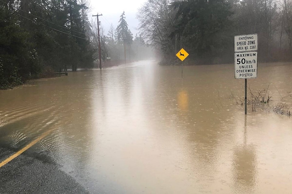
The scope of the project included updating the outdated regulatory flood hazard maps for the Englishman River and Little Qualicum River, assessing the river channel position to gauge any changes over time, and completing a high level risk assessment to identify vulnerabilities. Both rivers are known to be the source of flooding in District 69.
General river flooding occurs when water levels rise above their banks and flow into low lying areas that are otherwise dry or regarded as floodplains. High river flows are caused by significant heavy rainfall events occurring in the fall and winter months.
“Climate change is generally expected to increase the severity and the frequency of river flooding,” said Jeff Marvin, project engineer at Kerr Wood. “The amount of winter precipitation will increase into the future. It is also predicted warmer temperatures will cause more of this precipitation to fall as rain instead of snow.”
READ MORE: Mapping of Island river’s floodplain to aid in future flooding risks
The study has quantified the flood impacts and mapped the communities that will be exposed to flooding such as residential homes. As well, an assessment of key tangible community elements that are in direct exposure to flooding were identified and they include buildings, people, transporation disruption and water and wastewater infrastructure.
The areas at risk for flooding in the future include the residential neighbourhoods on Martindale Road and San Pariel along the Englishman River; and Surfside along Little Qualicum River. The tourist destinations and parks that may be impacted by projected flooded flood events include Rathrevor campground, Surfside Resort, Pathfider Camp Resorts, Cedar Grove RV Park & Campground, Riverside Resort and Qualicum National Wildlife Area.
The critical roads likely to be impacted include Martindale Road, Plummer Road, Kinkade Road and Highway 19A. The water and wastewater infrastructure located in the floodplains and are at risk to potential damages are San Pareil Water Intake, Surfside Groundwater Wells and Kinkade Wastewater Pump Station.
The RDN board endorsed staff recommendation that the completed flood plain maps be shared to the public by posting it on the district website.
Once the Nanaimo River project is completed, the plan is to update the RDN’s Floodplain Bylaw for developments. It will include the new flood mapping information, clarify terminology and remove redundancies.